Overview of Ha Noi
Ha Noi, capital city of the Socialist Republic of Viet Nam, is the country's political, cultural, scientific and technological center, and plays an important role in economy and international trade.
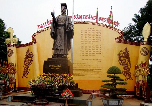 |
Statue of Ly Thai To King, who selected Ha Noi as the capital city in 1010.
Geographic
Ha Noi is located at latitudes 20°53' - 21°23' N and longitudes 105°44' - 106°02' E. It is bordered by Thai Nguyen and Vinh Phuc provinces in the north, Ha Nam and Hoa Binh in the south, Bac Ninh, Bac Giang and Hung Yen in the east, and Hoa Binh, Phu Tho in the west.
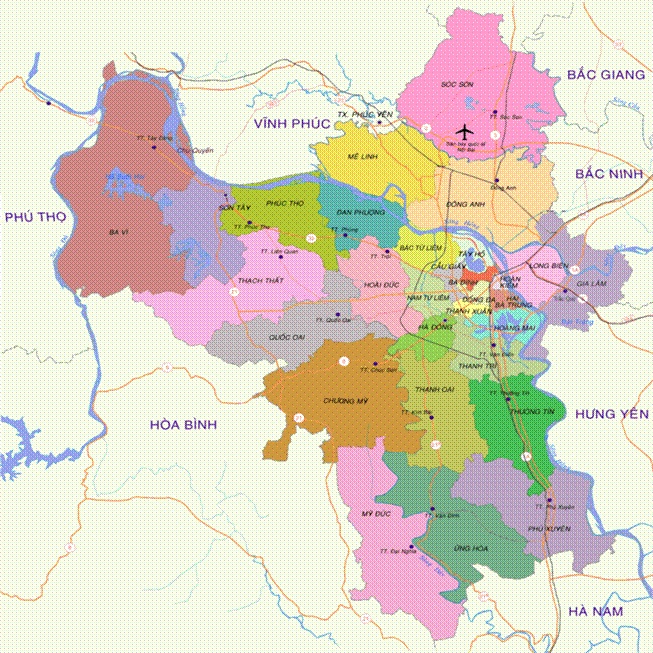 |
Map of Ha Noi
Natural area
After expanding administrative boundaries in 2008, Ha Noi now covers an area of 334,470.02 hectares and has population of over 7 million. The city is listed among 17 capital cities with the biggest area worldwide. There are 30 administrative units at district and town level, and 577 communes, wards and towns.
Ha Noi contains three basic kinds of terrain including the delta area, the midland area and mountainous zone. The terrain is gradually lower from the north to the south and from the west to the east, with the average height ranging from 5 to 20 meters above the sea level. Hills and mountains are located mostly in the northern and western parts of the city. The highest peak is Ba Vi with 1,281 meters.
Land use allocation according to 2010 Statistical Yearbook of Ha Noi by Ha Noi Statistics Office:
- Land used for agriculture, forestry and fisheries: 188,601.1 hectares
- Non-agricultural land: 134,947.4 hectares
- Unused land: 9,340.5 hectares
Hydrological
Currently, there are seven rivers flowing through Ha Noi, including Hong (Red River), Duong, Da, Nhue, Cau, Day, Ca Lo. The length of the Red River flowing through the city is 163 km, accounting for one third of its length in Viet Nam. Along with rivers, the city has hundreds of lakes and ponds, which contribute to regulating temperature of urban area and creating beautiful landscape.
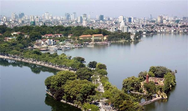 |
West Lake and Truc Bach Lake are divided by Thanh Nien Street.
Climate
Ha Noi experiences typical weather of tropical monsoon type with four seasons: Spring, Summer, Autumn and Winter. Spring begins in February (January according to Lunar Calendar). Summer, from May until August, is characterized by hot weather and high rainfall. September to October is fall, characterized by a decrease in temperature. Winter, from November to January, is dry and cold.
The city averages over 1,700 millimeters of rainfall per year, equivalent to 114 days with rain. Average radiation is 122.8 kcal per square centimeters; annual average temperature is 24.9 Census degrees and average humidity ranges from 80 to 82%.
Over the past years, Ha Noi experienced abnormal changes of climate. In May 1926, a terrible heat wave hit the city with highest temperature up to 42.8 Celsius degrees. In January 1955, it experienced one of the coldest winters with lowest temperature of 2.7 Celsius degrees. In November 2008, Ha Noi suffered the hardest rain ever and the worst flood on record, which killed many people and caused considerable material damage.