Geographical introduction and overview
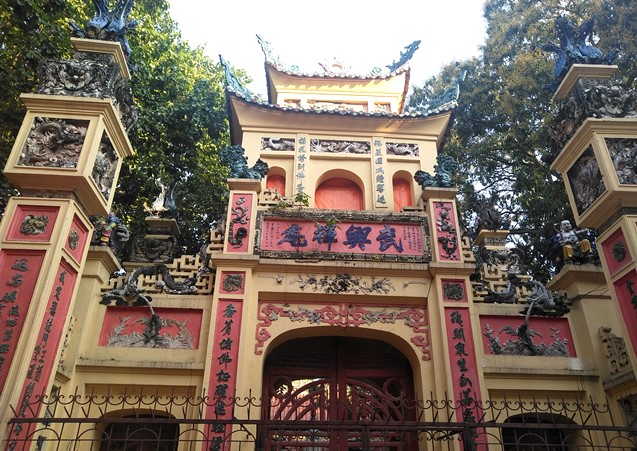
VGP - Ha Noi Capital of the Socialist Republic of Viet Nam is the nerve center of politics, culture and science and technology as well as the major center of trade and international economy of the country. For over 1,000 years of development, since King Ly Thai To chose Dai La near the To Lich river estuary as a place for the eternal capital, Ha Noi has witnessed the rise and fall of most of Viet Nam’s feudal dynasties of Ly - Tran - Le - Mac - Nguyen. The Thang Long Citadel was the trading, cultural and educational center of the North.
 |
Ly Thai To monument at Hoan Kiem Lake, Ha Noi
GEOGRAPHICAL LOCATION
Geographical coordinates: Ha Noi is located between 20°53' and 21°23' North latitude and 105°44' and 106°02' East longitude, adjacent to Thai Nguyen and Vinh Phuc provinces in the North; Ha Nam and Hoa Binh provinces in the South; Bac Ninh, Hung Yen and Bac Giang provinces in the East and Hoa Binh and Phu Tho provinces in the West.
 |
Map showing the administrative boundaries of Ha Noi
Natural area:
In accordance with Conclusions of the 6th plenary meeting of the 10th Party Central Committee and the Resolution No. 15/2008/NQ-QH12 of the 3rd meeting of 12th National Assembly, dated May 29, 2008, which took effect on August 1, 2008, the entire political system of Ha Noi after consolidation and expansion of administrative boundaries includes the capital of Ha Noi, Ha Tay province, Me Linh district of Vinh Phuc province and 4 communes in Luong Son district of Hoa Binh province. After expansion, the total area increased to 334,470.02 hectares, more than 3 times larger than before and became one of the 17 largest capitals in the world. The total population increased to more than 7 million people. The Capital now consists of 30 district-level administrative units and 577 communes and wards.
Ha Noi now has mountains, hills and terrains descending from North to South and from West to East, in which plains account for up to three-quarters of natural area of the city. The average height of Ha Noi is from 5 to 20 meters above sea level. The high mountains are concentrated in the North and the West. The highest peaks are BaVi at 1,281 meters height, Gia De at 707 meters, Chan Chim at 462 meters, Thanh Lanh at 427 meters and Thien Tru at 378 meters. The internal area has some low hillocks such as Dong Da mound, Mount Nung.
The area of land use allocation (332,889.0 hectares)
- Land for agriculture, forestry and fisheries: 188,601.1 ha
- Non-agricultural land: 134,947.4 ha
- Unused land: 9,340.5 ha
(According to the "Statistical Yearbook of Ha Noi in 2010," the Statistics Office of Ha Noi).
Hydrology:
Ha Noi is formed from the Red River Delta, geographically characterized as a "City of rivers and lakes" or "City inside rivers". Thanks to the large and small rivers flowing tirelessly through over thousands of years that bring fertile to the land. Currently, there are 7 rivers running through Ha Noi including Red, Duong, Da, Nhue, Cau, Day and Ca Lo Rivers. In particular, Red River section running through Ha Noi is up to 163km (representing 1/3 of the length of the river flowing through the territory of Viet Nam). In the inner city, beside the two rivers - To Lich and Kim Nguu - there is also a system of lakes and marshes acting as the drainage path of Ha Noi.
 |
Thanh Nien Road - barrier between West Lake and Truc Bach Lake
In the last century, there were over 100 large and small lakes, most of which were natural lagoon pools, the remains of former river sections, some were artificial lakes transformed from boggy fields into lakes. At present, although the majorities were leveled for construction, there remain hundreds of large and small lakes and marshes distributed across wards and communes of the Capital of Ha Noi. The most famous ones are Hoan Kiem Lake, West Lake, Quang Ba, Truc Bach, Thien Quang, Bay Mau, Thanh Nhan, Linh Dam, Yen So, Giang Vo, Dong Mo, Suoi Hai, etc.
These lakes of Ha Noi are not only huge water reservoirs but also a natural air conditioning system reducing the heat in the inner city coming from blocks of concrete, steel, asphalt and the operation of plants, etc. Ha Noi's lakes not only create a cool climate for the city - an urban microclimate - but are also famous beauty spots, unique cultural areas of Thang Long – Ha Noi.
Climate:
Located in the tropical monsoon region, Ha Noi’s climate is characterized by humid monsoon with hot and rainy weather in the summer and cold weather and little rain in the winter. The weather is divided into four distinct seasons of the year: Spring, Summer, Fall, Winter. Spring begins in February (or lunar January) and lasts until April. Summer starts from May to August, with hot but rainy weather. Autumn starts from August to October, with cool weather and falling leaves. Winter starts from November to January of the following year with cold and dry weather. There is only a relative distinction between the four seasons because winter can comes early in some years and late in others. Some years, summer lasts longer with temperature up to 40°C, while some years, temperature can reach below 5°C in the winter.
Ha Noi receives abundant solar radiation throughout the year. The total average annual amount of radiation accounts for about 120 kcal/cm². The average annual temperature is 24.9°C, average humidity is 80-82%. Average rainfall is over 1700 mm/year (about 114 days of rain/year).
In its development history, Ha Noi has experienced numerous sudden changes in weather. May 1926, Ha Noi experienced an awful sunny period with day temperatures recorded at 42.8oC. January 1955 experienced the coldest winter in history. Ha Noi lived in the cold with the lowest temperature of 2.7oC. And most recently in November 2008, after the expansion of administrative boundaries, Ha Noi was hit by an unprecedented violent rainstorm. Almost all the streets were submerged under water. Rainfall exceeding all forecasts caused a historic flood in Ha Noi, killed many people and caused considerable material damage.