Ha Noi approves revised Red River urban zoning plan
VGP - The revised Red River urban zoning plan will open up new development space for Ha Noi, gradually transforming the river into a strategic landscape, cultural and economic axis of the capital.
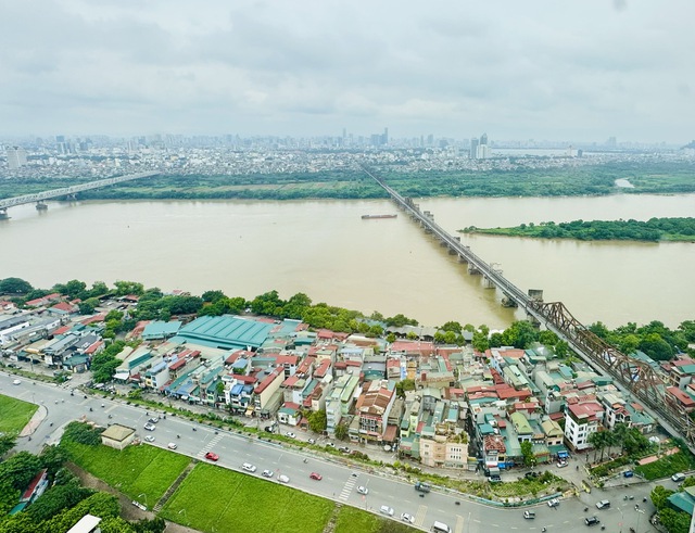
Chairman of the Ha Noi People's Committee Vu Dai Thang has signed a Decision approving the overall adjustments to the Red River urban zoning plan at a scale of 1:5,000, covering areas on both bank of the Red River from Hong Ha Bridge to Me So Bridge.
Under the revised plan, the planning area covers parts of 16 wards and communes, namely Thuong Cat, Dong Ngac, Phu Thuong, Hong Ha, Bo De, Long Bien, Linh Nam, O Dien, Me Linh, Thien Loc, Vinh Thanh, Dong Anh, Bat Trang, Thanh Tri, Nam Phu and Hong Van.
The plan was renewed to concretize the orientations set out in Ha Noi's 100-year master plan, identifying the Red River as a strategic axis, a central green corridor, and a hub for culture and innovation, as well as an economic, commercial, service and urban development axis of the capital.
Future urban development, the use of riverbank areas, and the allocation of buildings and infrastructure must be validated through hydrological and hydraulic modelling to ensure flood prevention and control, dyke safety and adaptation to climate change.
The plan also seeks to balance between urban development and preservation of historical and cultural values, traditional craft villages and river ecosystems. The renovation, upgrading and redevelopment of residential areas outside the dykes will go hand in hand with improving living standards and ensuring social welfare.
The overall objective is to establish a green corridor along the Red River associated with cultural and creative activities, while promoting the area's landscape, cultural and historical assets.
Development on both sides of the river will preserve flood drainage space and ensure the safety of the dyke system. Public facilities, parks, cultural venues, tourism services, entertainment and recreational facilities, and other urban functional areas will be arranged to strengthen connectivity between the two riverbanks and the central urban area.
The two banks will serve as the central urban area's green, cultural, historical and landscape corridor, as well as public spaces for cultural activities, festivals, tourism, sports and community life.
The scope of the revised plan spans approximately 40 kilometers along the river corridor. The zone is currently home to more than 279,500 residents and 123 historical and cultural heritage sites.
The population of the entire planned area is expected to reach approximately 800,000 to 1.2 million people.
The projected building coverage ratio is 35 percent–40 percent for residential areas and 30 percent for service and public facilities./.